Tropical Storm Bertha Makes Louisiana Landfall As Warning Extends Towards Texas
 Published By
Olivia
Published By
Olivia
Published:
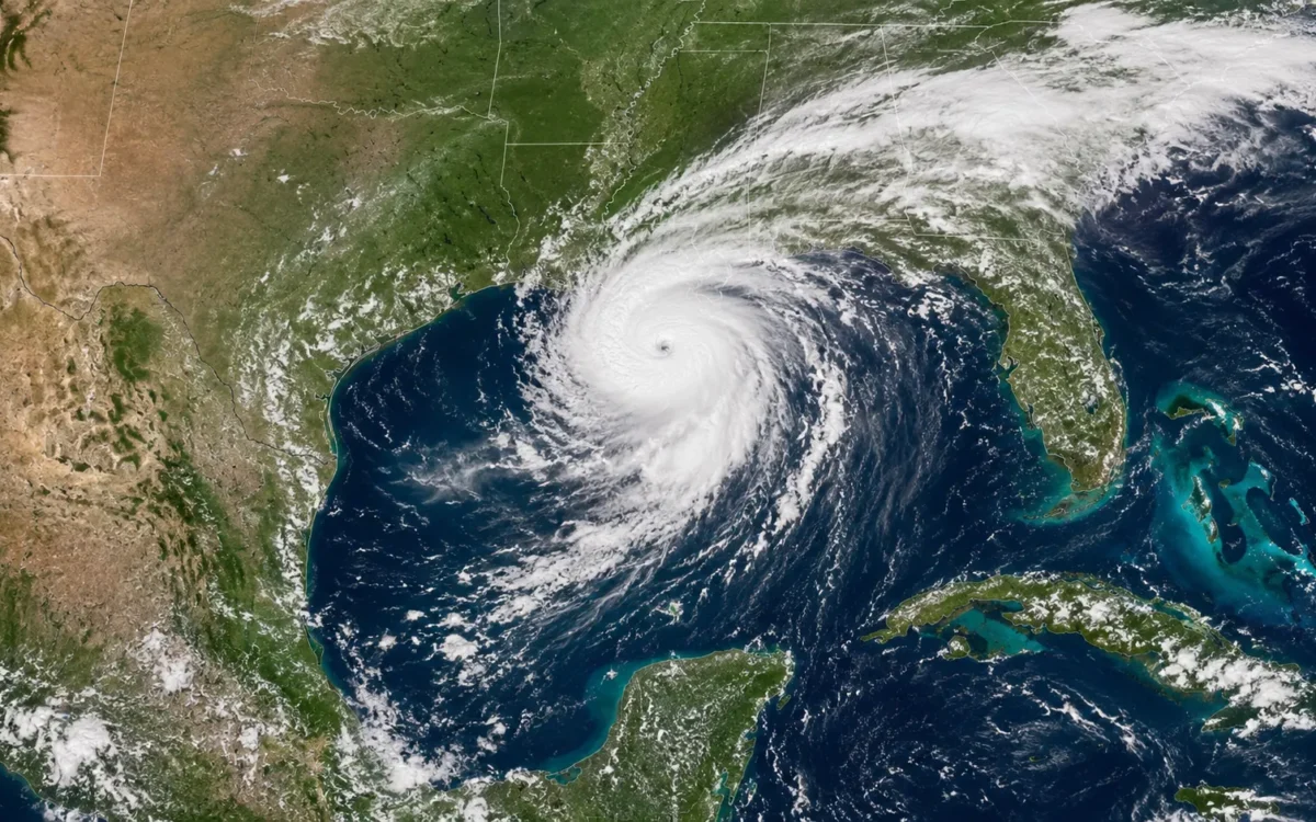
Tropical Storm Bertha has crossed Louisiana with 45mph winds after earlier reaching 60mph over the Gulf of Mexico. Forecasters have extended warnings towards Texas, where heavy rain, coastal flooding and dangerous surf remain possible.
Tropical Storm Bertha made landfall in southern Louisiana on Wednesday, July 22, before turning west along the Gulf Coast and prompting an extension of weather warnings into Texas.
The storm crossed the coast in St Bernard Parish, about 40 miles east of New Orleans, with maximum sustained winds of approximately 45mph. Tropical storm-force winds extended as far as 160 miles from its centre, meaning hazardous conditions were being felt well beyond the landfall point.
Bertha had previously strengthened to around 60mph over the Gulf of Mexico. Earlier reports warning of a potentially stronger impact therefore reflected forecasts issued before the storm weakened on its approach to Louisiana.
By 10pm Central Daylight Time on Wednesday, the National Hurricane Center placed Bertha about 75 miles south-west of New Orleans and 135 miles east-south-east of Lake Charles. It was moving west at 12mph with sustained winds of 45mph.
Tropical Storm Warning Reaches Upper Texas Coast
The tropical storm warning was extended westwards from Cameron, Louisiana, to Sargent, Texas. The warning area stretched from the Alabama-Mississippi border across much of the northern Gulf Coast and included metropolitan New Orleans and Lake Pontchartrain.
Forecasters expected Bertha’s centre to remain near or along the Louisiana and upper Texas coasts through Thursday afternoon before moving farther inland over Texas during the evening and overnight.
The storm was forecast to retain tropical storm strength until reaching the upper Texas coast. Further weakening was then expected, with the system likely to dissipate inland over Texas by Thursday night or Friday.
The National Hurricane Center warned that Bertha could produce between two and four inches of rain along the Texas Gulf Coast and across southern Texas, with isolated totals reaching six inches. Urban areas were considered particularly vulnerable to localised flash flooding.
A storm surge of between one and three feet above normally dry ground was also possible from the Alabama-Mississippi border to Port Bolivar in Texas, as well as around Lake Pontchartrain. The precise extent of coastal flooding would depend on the storm’s timing in relation to the tide.
Swells generated by Bertha were expected to continue spreading west along the northern Gulf Coast, creating potentially life-threatening surf and rip-current conditions.
Beaches Closed As Authorities Monitor Flooding Risk
Parks, piers, beaches and some low-lying roads were closed across parts of the Gulf Coast before the storm arrived. Residents in flood-prone areas were offered sand for sandbags, while swimmers were warned to stay out of the water because of rough seas and strong currents.
Louisiana Governor Jeff Landry described the forecast as encouraging but urged residents to remain prepared for flooding. Early reports indicated that much of the heaviest rain had remained offshore and that widespread destruction was not expected, although local flooding and wind damage remained possible.
The storm also affected offshore energy operations. Chevron shut production at its Petronius platform and evacuated workers as a precaution, while BP removed some non-essential personnel from two Gulf facilities. The Gulf’s offshore waters account for about 14 per cent of United States crude oil production, making even a relatively weak storm potentially disruptive to the energy sector.
Bertha is the second named storm of the 2026 Atlantic hurricane season, following Tropical Storm Arthur in June. Although its winds weakened before landfall, the storm’s broad circulation means flooding, coastal surge and dangerous sea conditions remain the principal threats as it tracks towards Texas.
About the Journalist
Olivia covers London life, culture and lifestyle for Londoner. Her work includes food, shopping, neighbourhood trends, attractions, local experiences and practical guides for residents and visitors. She focuses on engaging stories that reflect everyday life across the capital.